We prepared updated versions of habitat suitability maps, a revised report, and the newly generated GIS files. We managed to acquire more lynx occurrence data from the Alpine region and with this improve the accuracy of habitat suitability predictions for lynx in the Alps.
Having good occurrence data means that the data is accurate, precise, and representative of the species’ distribution. By combining multiple sources of information, we are able to create a more complete and representative picture of the species’ habitat requirements and improve the accuracy of the habitat suitability model. Since the publication of the first report, which may have been biased towards forested areas, we have included additional data in the model training dataset. The additional data consisted of C1 and C2 occurrences (SCALP), camera trapping data and additional GPS telemetry data from the Tarvisio area (2 lynx) and Kalkalpen National Park (6 lynx). We would like to thank Christian Fuxjäger for providing the telemetry data from Kalkalpen and Anja Jobin Molinari for the data from Tarvisio.
The updated model’s prediction is more balanced between the study areas (Dinaric and Alpine region), as can be seen in figures 1 and 2. While the Dinaric area still hosts a larger area of suitable and optimal habitat patches, the prediction of suitable and especially optimal habitat patches in SE Alps covers a wider area than previously reported.
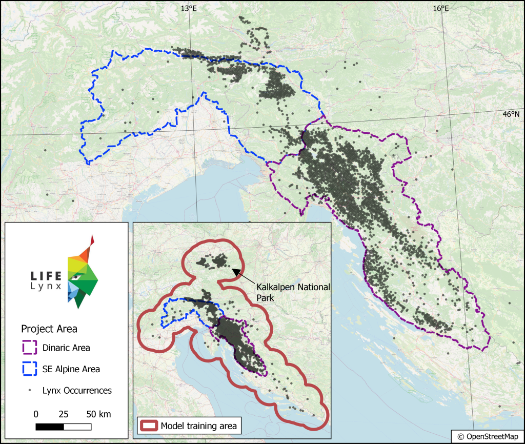
Outline of the project area, study areas, and thinned occurrence dataset.
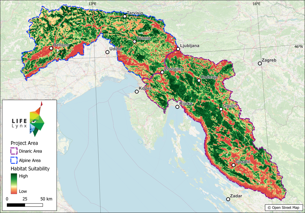
Maxent based Habitat Suitability Map. Green shades indicate suitable habitat while red shades indicate less favourable and unsuitable habitat.
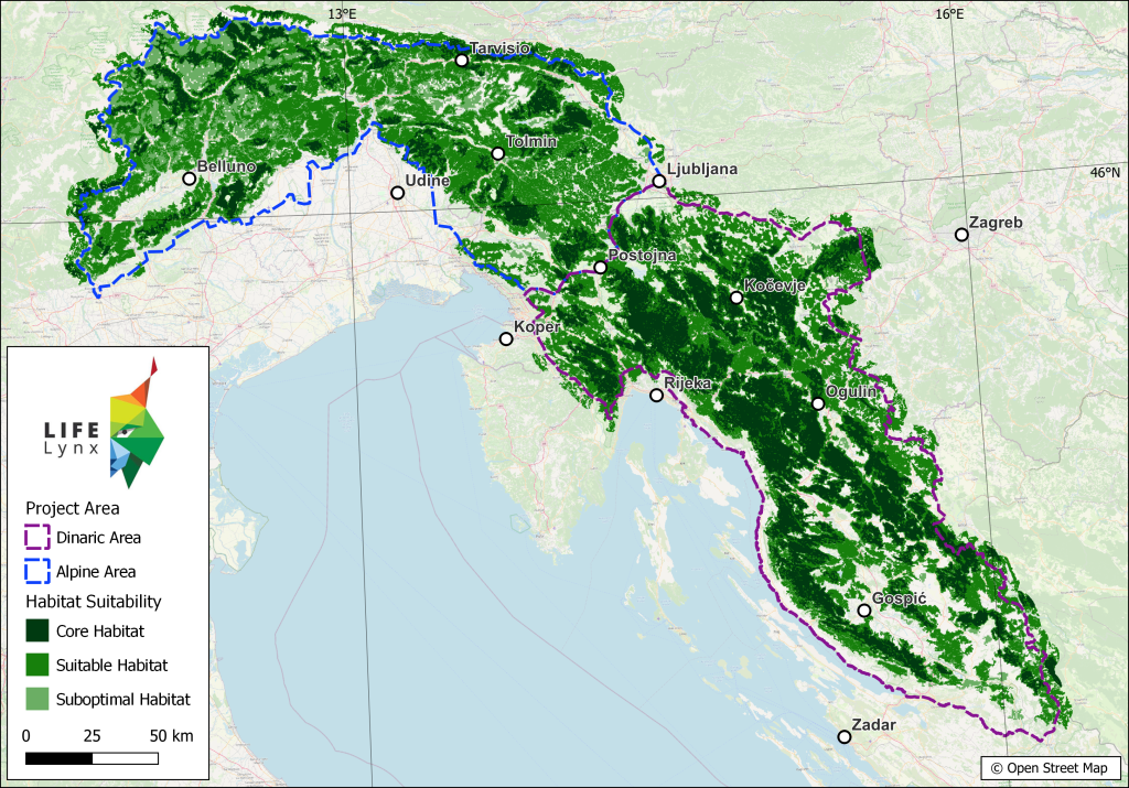
Suitable habitat and optimal habitat patches. Large amount of the Dinaric area is classified as suitable and even optimal habitat. These patches also seem to be well connected and in practice probably function as a single habitat patch. Situation in the Alps is slightly different, as optimal habitat patches are smaller and farther apart, with suitable habitat patches creating “stepping stones” for dispersing lynx.
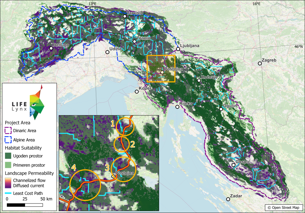
Map shows landscape permeability overlaid with optimal habitat patches and least cost paths amongst these patches. The purple colour indicates diffuse permeability, which in practice means that an animal can move through space unhindered. In some areas, however, the passage is highly channelized (pink and yellow shades), which means that the lynx has little opportunity to take an alternative route. Cases where such bottlenecks are crossed by linear barriers (e.g. motorway, railway) are particularly problematic, as such barriers can be virtually impassable for the lynx. The inset map shows that Ljubljana-Koper highway crosses four potential corridors, first being the Vrhnika-Logatec section, second Logatec-Unec, third Unec-Postojna and fourth Postojna-Divača section. Areas with impeded permeability were made transparent for clarity.