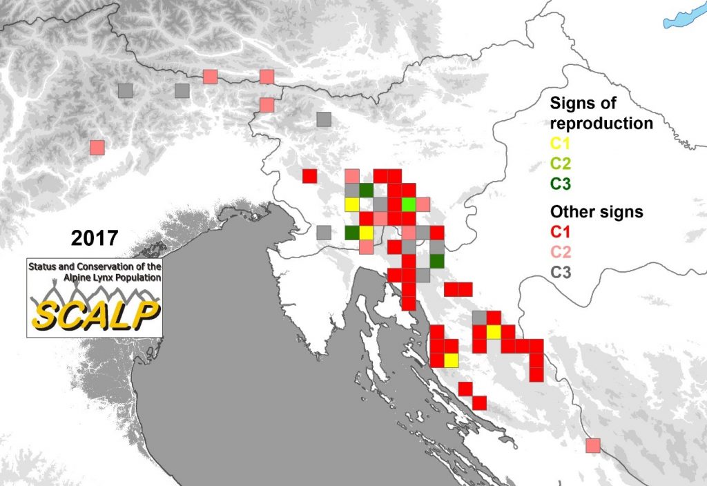
We prepared a map of lynx habitat occupancy based on SCALP data (Status and Conservation of the Alpine Lynx Population). The data are divided in a three-level classification of field records. The first category (C1) represents ‘hard fact’ data (e.g. good quality and georeferenced lynx photos); the second category (C2) includes confirmed data (e.g. tracks verified by an expert); and the third category (C3) are unconfirmed data (e.g. any kind of direct visual observation). Scientists, hunters, naturalists and others provided the data. Chance observations are continuously collected and compiled by a network of people trained to recognize and assess different signs of lynx presence and are annually unified in the SCALP database.
database.